

By Curt Freeman
For Mining News
State, feds plan digital maps for Alaska
Long overdue collaborative initiative reflects growing awareness that current maps do not meet 'National Map Accuracy Standards'
Last updated 7/29/2012 at Noon
In a long overdue step to bring Alaska into the 21st Century, state and federal agencies met in late June to discuss collaborative funding strategies for Alaska's Statewide Digital Mapping Initiative, an enterprise designed to create Alaska's first high-quality digital topographic map.
The roundtable was convened by Alaska Lt.
Gov. Mead Treadwell and the Assistant Secretary for Water and Science, U.S. Department of Interior.
Alaska remains the only state in the United States that has not been digitally mapped and its current maps do not meet "National Map Accuracy Standards." Alaska has contributed funding in the past that resulted in digital mapping that covered 10 percent of Alaska.
In a statement that will live beyond this administration, Treadwell said, "Mars and the moon have been better mapped than Alaska." As someone who has flown and walked over large areas of the state, I can attest to the accuracy of the lieutenant governor's statement.

I have found mountain tops where the maps say none exist, and I have gone looking for mountain tops shown on maps only to find that those peaks, in fact, do not exist in the real world.
While Alaska's Statewide Digital Mapping Initiative will greatly assist the mineral industry, it also will have immediate applications across a wide spectrum of disciplines.
Western Alaska
Tintina Resources Inc. reported the commencement of the first exploration drill campaign at its Baird project in the Western Brooks Range.
The company plans to test several kilometric-scale copper-zinc surface anomalies with 2,500 meters of drilling.

The program will focus on previously identified mineral targets at the Omar, Deadfall, and Frost targets.
The Omar target exhibits mineralization over an area measuring 4 kilometers by 2 kilometers (2.5 miles by 1.24 miles) with coincident copper and zinc soil and rock chip anomalies.
Historic drilling results showed significant bedrock mineralization including 22.8 meters grading 3.99 percent copper, 6.1 meters grading 9.37 percent copper and 7.32 meters grading 2.95 percent copper.
The Deadfall target consists of a 4-kilometer- (2.5 miles) long zinc and copper anomaly.
Although no drilling has been completed on this target, channel sampling has identified significant bedrock mineralization, including 12 meters grading 10.1 percent zinc and 42.4 grams per metric ton silver within 36 meters grading 6 percent zinc and 21.7 g/t silver.

Graphite One Resources Inc. reported rock sampling results and commencement of drilling at its Graphite Creek graphite prospect on the Seward Peninsula.
Twelve rock grab samples were collected along the electromagnetic conductor and 10 of the samples contained graphite with grades, ranging from 0.77 percent to 41.4 percent graphitic carbon.
Follow-up work included collection of 307 rock grab samples, geologic mapping along the known electromagnetic conductor and completion of two drill holes which tested surface graphite showings near Graphite Creek.
The company also collected three surface bulk samples which total about 10.5 metric tons.
These samples will be used for mineralogy and metallurgical testing.
Millrock Resources Inc. provided an update on its plans for its Humble project in southwestern Alaska and its Council project on the Seward peninsula. At Humble, Millrock and partner Kinross Gold Corp. are contemplating a follow-up drilling program for later in 2012. At Council, Millrock and partner Kinross plan to drill six shallow holes to test strong surface gold geochemical anomalies and gold-bearing veins discovered by prospecting crews at the Elkhorn prospect. The project is budgeted at $1 million.
Novagold Resources Inc. and partner Barrick Gold Corp. approved their recently completed update feasibility study and approved the long-awaited permitting process for their Donlin Creek gold deposit.
When in production, the deposit is expected to produce approximately 1.5 million ounces of gold per year in the first five full years of production and average more than 1 million ounces of gold per year over a 27-year mine life.
Current measured and indicated resources stand at 39 million ounces of gold contained in 541 million metric tons grading 2.2 grams per metric ton gold.
Permitting, through the federal National Environmental Policy Act will include completion of an environmental impact statement.
Nyac Gold LLC reported the completion of a 920-meter diamond drill hole at its Saddle Mountain prospect at its Nyac gold property under lease from Calista Corp. The hole was drilled near the center of a 7.5-acre hydrothermal breccia pipe that is coincident with a roughly circular 2,450-meter diameter aeromagnetic anomaly thought to represent an underlying Cretaceous pluton.
Surface quartz vein samples in the breccia pipe have yielded up to 59.2 g/t gold with anomalous silver and mercury values.
The hole cut pervasively potassically altered andesite with biotite flooding plus disseminated and vein magnetite.
Anhydrite veining and flooding is prevalent to a depth of 750 meters.

Hydrothermal alteration and fluidized hydrothermal brecciation often obliterate original textures.
Significant intercepts include 16 feet grading 4.9 meters of quartz-carbonate vein breccia at 580 meters and 28 meters of intensely quartz-sericite-pyrite-altered porphyritic intrusive in two intervals below 812 meters.
The altered intrusive is similar to a mineralized cupola occurring elsewhere on the property that may have generated the placer gold deposit in the creek draining the cupola.
The hole was terminated in silicified quartz-sericite-pyrite-altered andesite that contains up to 2 volume percent fine quartz-chlorite-anhydrite stockwork.
The company intends to complete at least 2,440 meters of drilling in deep holes in the breccia pipe this season.

Liberty Star Uranium & Metals Corp. said it received of updated geophysical data from its ZTEM electromagnetic survey covering the south block of its Big Chuck project. Reprocessing of these data is in progress.
TNR Gold Corp. said drilling and other exploration work on schedule for start-up in mid-July at its Shotgun gold project. Objectives of the Shotgun Gold Ridge prospect drill program include about 1,500 meters of infill drilling to support an industry-compliant resource estimate, testing of new geophysical targets identified in 2011, further testing at depth on feeder zones discovered in 2006 and completion of additional geophysical surveys on other parts of the project.
Interior Alaska
Freegold Ventures Ltd. reported additional drilling results from its Golden Summit project near Fairbanks. At the Dolphin zone, significant results 136.7 meters grading 1.57 g/t gold in hole GSDL1213 within a broader zone of mineralization grading 0.82 g/t gold over 542.8 meters (collar to termination depth). Mineralization is hosted in pervasively sericite altered granodiorite cut by later sheeted and stockwork quartz veins. Elevated gold values are associated with disseminated and quartz vein-hosted arsenopyrite and pyrite with lesser silver and lead sulfosalts. Additional drilling is on-gong in the Dolphin zone and is planned for other areas of the project in 2012.
Teryl Resources Corp. reported that exploration work was planned for its Westridge gold project in the Fairbanks District. The proposed initial work programs will include locating and surveying historic drill holes on the ground within the claim block, a reconnaissance drilling program utilizing a small diameter drill rig, upgrading of access and water source areas, general reconnaissance of the placer potential on Moose Creek and securing a larger-diameter diamond drill or a reverse circulation drill for follow-up drilling. The company plans to complete 760 meters of drilling this season.
International Tower Hill Mines Ltd. provided an update regarding the optimization review of its Livengood project.
The company has determined that the most efficient and cost-effective path to permitting is to incorporate results from current engineering and metallurgical test work directly into a definitive feasibility study, which the company expects to complete in the first half of 2013.
Earlier this year, the company sent SGS Canada Inc. 10,800 kilograms of material from about 3,000 samples selected from throughout the deposit for the final stage of metallurgical optimization testing and analysis.
Results are pending.
Additional optimization work is looking at crushing and grinding and over-all mill scale options.
Mill and facilities condemnation studies also are ongoing.
Budget reductions have forced the company to postpone much of its district-wide exploration drilling program and reduce a portion of its condemnation drill program.
The company will focus on completing all the necessary field work and drilling to support the completion of a feasibility study and the environmental work needed to keep its permitting schedule on track.
The company also reported on the identification of five key exploration areas with the potential to provide substantial resource growth over time and which would be the focus of the company's future mine-area drill programs.
These areas include the Scraper Ridge, Money Knob Pit, SW, Gertrude Basin and Moose Gulch/Lucky Creek areas.
The presence of a combination of dikes, volcanic host rocks and a large gold in soil anomaly indicates potential for the discovery of mineral resources in the newly identified Scraper Ridge target.
Mineralization has been confirmed in scout hole MK-10-97 which intersected 1.52 meters of 4.82 g/t gold in the most favorable host rocks.
Gold in soil and other diagnostic geochemical pathfinders have outlined a large, coherent target area.
To date, almost all of the drill holes in the Money Knob deposit have bottomed in gold mineralization and six deep holes extending below the proposed 300-meter pit bottom penetrated intervals with similar gold grades to the main deposit.
Additional mineral resources may be defined below the current pit design by sequential drilling conducted as part of an ongoing mining operation.
Previously identified mineralized intercepts in the northern portion of the SW Zone include 15.24 meters at 3.69 g/t gold and 22.86 meters grading 0.86 g/t gold.
These intercepts are relatively shallow and indicate an opportunity for the delineation of resources that might extend early mining in the proposed pit towards the west.
Deep, well-mineralized intersections in the southern part of the SW zone offer the possibility of extending the present mineral resource to the southwest later in the life of the proposed project.
Geotechnical drilling in the Gertrude Basin area has intersected dike-related mineralization in favorable host rocks within a large gold in soil anomaly.
Significant results include 1.68 meters grading 5.72 g/t gold, 9.77 meters at 0.83 g/t gold and 9.85 meters assaying 0.65 g/t gold.
In the Moose Gulch/Lucky Creek area, northwest trending faults, dikes and anomalous gold in soils coincide.
Exploration and geotechnical drilling in the area has encountered gold mineralization, mostly in and immediately adjacent to dikes, including 3.56 meters at 2.0 g/t gold and 6.07 meters grading 0.67 g/t gold.
Alix Resources Corp. said it has completed phase 1 sampling at its Money Rock and West Pogo gold projects in the Goodpaster Mining District. Over 300 samples have been collected to date, including 210 soil, 34 stream sediment, and 82 rock grab samples. A 1,800-meter drilling program has now commenced. Previous work at West Pogo identified two zones of gold mineralization from rock-chip grab samples with up to 118.5 g/t gold. Drilling has begun within the larger of these two zones and is designed to test for potential mineralization along roughly northwest-trending structures identified through re-interpretation of geophysical data.
Sono Resources Inc. announced that it had changed its name to Alaska Gold Corp. and commenced its 2012 exploration program on its Bear project in the Circle District. The company collected 219 mobile metal ion geochemical samples and followed up with a three dimensional induced polarization/resistivity survey. The company hopes to identify 6 to 10 drill targets where it can subsequently complete 4,000 to 6,000 feet of diamond core drilling later in 2012.
In what we all hope is a shape of things to come, the Department of Transportation and Public Facilities announced that step one of the Roads to Resources program has begun with clearing and surveying of the proposed road from Manley Hot Springs to Tanana Village. Both the State of Alaska and the Alaska Industrial Development and Export Authority are funding this initial US$10 million effort. The goal will be creating of a summary document that will be subject to public comments. The land along this segment of the corridor is owned partly by the State of Alaska and partly by the Tozitna Native Corporation.
Alaska Range
Usibelli Coal Mine Inc. recently released updated demographics for Usibelli Mine employees. The mine employs 144 people full time with an additional seven seasonal employees. The average mine employee has been employed there for nine years. A total of 46 employees have been at the mine for more than 10 years, with 11 of those having been employed for more than 30 years at Usibelli Mine. Approximately 27 percent of the workforce, or 39 employees, are second, third or fourth generation employees.
Corvus Gold Inc. reported that joint venture partner Ocean Park Ventures Corp. has not finalized its exploration program for the summer, but has indicated to Corvus Gold that the work will be limited in scope as necessary to fulfill Ocean Park's remaining 2012 work commitment.
Pure Nickel Inc. said its US$4.9 million 2012 exploration program at the MAN project, funded by partner Itochu Corp., began in late May, with mapping, soil geochemistry and induced polarization geophysical surveys. Drilling began in late June with a total of 2,600 meters expected to be completed by the end of the program.
GTSO Resources said that, in addition to its gold properties already under evaluation, it has begun evaluation of tungsten prospects in Alaska. The initiative grew out of results from the company's black sands core samples collected in June.
Millrock Resources and partner Teck American Inc. said drilling has commenced at the Estelle project. The US$1.8 million drilling program will include seven holes totaling up to 1,500 meters of drilling. Five of the planned holes will be drilled at the previously drilled Oxide Ridge prospect. Previous drilling intersected variably altered magmatic intrusive rock with quartz veins and stockworks containing gold mineralization which returned a 0.43 g/t gold over 365.3 meters.
Corvus Gold Inc. reported that joint venture partner Westmountain Index Advisors Inc. will conduct additional exploration at the Terra property this summer. Work will include core drilling and installation and operation of a small mill that will utilize stockpiled material left on site. The company also plans to begin construction of the road from the project camp to the main mining area at the Ben Vein. Diamond drilling will focus on the continued extension of the Ben Vein to the north as well as infilling the additional 200 meters of vein extension delineated in 2011.
Northern Alaska
NovaCopper Inc. and NANA Regional Corporation Inc. reported initial industry compliant resources estimates for the Bornite copper-cobalt prospect at its Upper Kobuk project in the Ambler District.
At a 0.5 percent copper cutoff grade, the Ruby Creek Zone of the Bornite deposit contains indicated resources of 6.8 million metric tons at 1.19 percent copper, or 178.7 million pounds of contained copper.
In addition, at a 0.5 percent copper cutoff grade, the Ruby Creek zone contains inferred resources of 47 million metric tons of 0.84 percent copper, or 883.2 million pounds of contained copper.
The Ruby Creek zone resource does not include any of South Reef target mineralization located roughly 600 meters east of the Ruby Creek zone.
Exploration drilling at South Reef in 2011 encountered exceptional grade-thickness intervals, including 178 meters grading 4.01 percent copper, including a 34.7 meter section grading 12.03 percent copper.
Mineralization in the Ruby Creek zone occurs as two discrete strata bound lenses: the Lower Reef which outcrops and dips approximately 30 degrees to the northeast; and the Upper Reef lying roughly 150 meters above the Lower Reef stratigraphy and which includes a small high-grade zone named the No.1 Orebody by Kennecott.
Mineralization is hosted by a Devonian age carbonate sequence containing broad zones of silica-dolomite alteration and associated sulfide mineralization including bornite, chalcopyrite, chalcocite occurring as disseminations and vein stockworks as well as crackle and mosaic breccia fill and locally massive to semi-massive replacement bodies.
Four rigs are currently drilling at the project with the goal of completing 15,000-18,000 meters of diamond drilling in two principal areas: the South Reef and Ruby Creek zones at Bornite and the Sunshine deposit, a satellite polymetallic volcanogenic massive sulfide deposit located 12 kilometers west of the Arctic volcanogenic massive sulfide deposit where previous drilling identified significant intersections of massive sulfide mineralization in the same stratigraphic horizon as the Arctic deposit.
The US$16.5 million 2012 exploration program also consists of extensive surface exploration of the roughly 18 kilometer long belt of prospective carbonate stratigraphy adjacent to the Bornite deposit.
Two known mineralized occurrences (Aurora Mtn.
and Pardner Hill) along with broad areas of hydrothermal dolomite and anomalous soil geochemistry occur along the belt.
Surface exploration will utilize 60+ line kilometers of wide-spaced dipole/dipole induced polarization and radial line down-hole IP and 25 line kilometers of soil sampling.
Andover Mining Corp. reported initial drilling results from its 2012 drill program at the SUN copper-silver-lead-zinc-gold volcanogenic massive sulfide project in the Ambler District.
Drill hole SUN 12-29 was the first drill hole of the 2012 drill program and returned 8.6 meters grading 1.49 percent copper, 1.6 percent lead, 9.03 percent zinc, 66.2 g/t silver and 0.190 g/t gold from 71.9 to 80.5 meters depth, 6.2 meters grading 2.73 percent copper, 1.27 percent lead, 6.54 percent zinc, 116.4 g/t silver and 0.396 g/t gold from 100.5 to 106.7 meters depth and 2.3 meters grading 1.68 percent copper, 0.26 percent lead, 1.04 percent zinc, 48.9 g/t silver and 0.142 g/t gold from 130 to 132.3 meters depth.
Drilling continues on both the SUN and S.W. SUN deposits.
Goldrich Mining Company and partner NyacAU, LLC said they have received a placer mining permit for the Chandalar project in the Brooks Range. Ground preparation has begun and the companies anticipate the gold recovery plant will be set up by mid-August. Commercial production is anticipated to begin by June 2013, although limited production could begin as early as this summer. An eventual production rate of about 10,000 ounces of fine gold per season for 25 years is anticipated with the option to increase this production rate by establishing a second gold recovery plant.
Southeast Alaska
Grande Portage Resources Ltd. said it has begun drilling at its Herbert Glacier gold project in the Juneau Gold Belt. The 2012 70-hole drill program will be divided into two primary objectives deeper drilling on 25-meter spacings in order to convert inferred ounces into the measured and indicated category and an additional 3000 meters of relatively shallow drilling on four of the five principle vein structures. Each structure has a surface expression of about 1,000 meters.
Arrowstar Resources Ltd. reported initial results from its first exploration program on its Snettisham iron ore prospect about 30 miles southeast of Juneau. Ten grab samples were tested for magnetic separation using a Davis Tube Test methodology with recovering ranging up to 86.7 percent of the magnetite in pyroxenite host with an over-all iron content of 57. A bulk sampling program is planned as the next step to concentrate the sampling in these two areas to determine the extent of each occurrence. Proposals are being reviewed for a ground based magnetic program that will be conducted prior to initial drill testing.
Heatherdale Resources Ltd. reported details of its planned 2012 exploration program at its Niblack volcanogenic massive sulfide deposit.
The 2012 program will be staged from surface sites to test areas that could not be efficiently tested from existing underground workings.
The 15,000-foot program mainly targets the open extensions of the Lookout and Trio deposits, as well as focusing on several other key targets along the property's six miles of prospective felsic stratigraphy, which is known to host at least six massive sulfide zones.
Current resources comprise indicated resources of 5.6 million metric tons grading 0.95 percent copper, 1.75 g/t gold, 1.73 percent zinc, 29.52 g/t silver and an additional inferred resource of 3.4 million metric tons grading 0.81 percent copper, 1.32 g/t gold, 1.29 percent zinc, 20.10 g/t silver.
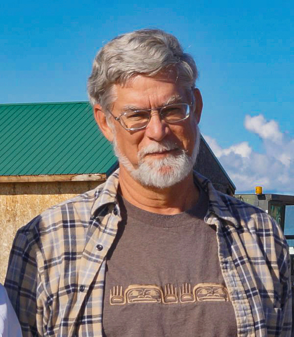
Curt is President of Avalon Development Corporation, a mineral exploration consulting firm based in Fairbanks, Alaska. He is a U.S. Certified Professional Geologist with the American Institute of Professional Geologists (CPG #6901) and is a licensed geologist in the State of Alaska (Lic. # AA 159).
- Email: [email protected]
- Phone: 907-457-5159
- Contact Curt Freeman
Reader Comments(0)