Alaska drill results continue to roll in
From fantastic copper grades at Trilogy's Bornite to stellar silver at Hecla's Greens Creek, assays bode well for 49th state North of 60 Mining News – December 1, 2018
Last updated 9/25/2020 at 7:36am
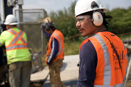
Alaska Peninsula Corp. hopes its shareholders can realize economic benefits from participating in an environmentally responsible mine at the Pebble copper-gold-molybdenum deposit in Southwest Alaska.
WESTERN ALASKA
Northern Dynasty Minerals Ltd. announced that it had finalized a surface right of way agreement with Alaska Peninsula Corporation for use of that latter's lands for the construction and operation of transportation infrastructure associated with the Pebble copper-molybdenum-gold project. Alaska Peninsula Corporation is an Alaska Native village corporation with extensive land holdings proximal to the Pebble site and more than 900 shareholders, many of which live in the nearby villages of Newhalen and Kokhanok. The lands are included in the Pebble project description submitted to the US Army Corps of Engineers last year as part of the federal Environmental Impact Statement permitting process. The right of way agreement includes land south of Lake Iliamna that would link a port site on Cook Inlet to a ferry landing site west of the village of Kohkanok, as well as land north of Lake Iliamna that would link a ferry landing site west of the village of Newhalen to the site of the proposed Pebble mine. Under terms of the deal, operators at Pebble will make annual toll payments to Alaska Peninsula Corporation and pay other fees prior to and during project construction and operation. Alaska Peninsula Corporation will be granted "preferred contractor" status at Pebble, which provides a preferential opportunity to bid on Pebble-related contracts located on APC lands. The two parties also have agreed to negotiate a profit sharing agreement that will ensure Alaska Peninsula Corporation and its shareholders benefit directly from the profits generated by mining activity in the region.
INTERIOR ALASKA
Kinross Gold Corp. announced third quarter 2018 results from the Fort Knox mine near Fairbanks. The mine produced 51,984 ounces of gold at a cost of $1,015 per oz in the third quarter, versus 101,041 oz of gold at $641/oz in the year previous period. Production was lower year-over-year largely due to the impact of the pit wall slide in the first quarter, higher than average amount of rainfall in the area which affected geotechnical stability during the quarter, lower mill grades and fewer tons of ore processed on the heap leach pads. Cost of sales per ounce sold was higher compared with the previous quarter and prior year primarily due to the decline in mill grades and lower gold equivalent ounces sold. The mill treated 2,718,000 metric tons of ore grading 0.42 grams per metric ton gold, with a mill recovery of 81 percent. The heap leach saw additions of 3,262,000 tons of ore grading 0.19 g/t. Meanwhile at Gilmore, an expansion project immediately west of the current open-pit and associated infrastructure at Fort Knox, preparations are on schedule for major construction of the new heap leach pad. Drilling and expansion of the dewatering system was begun with start of stripping planned for mid-2019. Engineering is now essentially complete and initial production is on schedule for early 2020.
Freegold Ventures Limited reported preliminary results from the 2018 drilling program on its Shorty Creek copper-molybdenum-gold prospect near Livengood. A total of 1,148 meters was drilled in two holes during the fall program. Assays are pending. The drilling was designed to expand mineralization in the Hill 1835 prospect. The company also indicated that metallurgical work is underway aimed at both determining copper, silver and gold recoveries through locked cycle testing as well as evaluating the potential for a gravity circuit to recover the tungsten, which occurs as wolframite. Results from this metallurgical work are pending.
ALASKA RANGE
White Rock Minerals Ltd. announced the staking of additional claims at its Red Mountain volcanogenic massive sulfide project in the eastern Bonnifield District. The staking included 524 new state of Alaska claims, bringing the land holding to 754 claims covering 475 square kilometers (183 square miles) of land. The majority of the expanded area forms a contiguous block of mining claims that now extend the Red Mountain project to the west along strike and south into the prospective footwall stratigraphy identified as containing multiple prospective time horizons. In addition, the company staked claims over a number of additional volcanogenic massive sulfide mineral occurrences including at Anderson Mountain, Virginia Creek, West Fork, Peaches, Keevy Peak, Kenny, Sheep Creek and Surprise Creek. These prospects have been the subject of past exploration with VMS characteristics identified from mapping, rock chip sampling and in some cases drilling. The Anderson Mountain prospect was discovered in 1975 by Resource Associates of Alaska Corp., Getty Mining Company and Phelps Dodge Corporation. Two of three drill holes intersected significant mineralization AM-76-2 intersecting 1.7 meters grading 8.5 percent zinc, 2.1 percent lead, 61 g/t silver and 1.2 percent copper from 60.4 meters and AM-76-3 intersecting 0.6 meters grading 22 percent zinc, 4.8 percent lead, 161 g/t silver and 0.6 percent copper from 42 meters. Massive sulfide zones extend for 1,200 meters SW-NE and are hosted by black graphitic argillites within a Devonian sequence of metasedimentary and metavolcanic rocks. The Virginia Creek prospect was also discovered by RAA, Getty and Phelps Dodge in 1975. Records indicate that four of 6 drill holes successfully intersected sulfide mineralization along 300 meters of strike within 45 meters of surface Significant mineralization includes hole VC-2 which intersected 14.8 meters grading 3.3 percent zinc, 0.8 percent lead, 78 g/t silver, 0.2 g/t gold and 0.5 percent copper. The Sheep Creek prospect, also known as the Last Chance or Gossan Peak prospect, was also discovered in 1975 by RAA, Getty and Phelps Dodge. The discovery exposure at Gossan Peak extends over 200 meters of strike and is up to 100 meters wide with anomalous prospect sites defining a 3,000-meter-long east-west target horizon. Rock samples returned values up to 11 percent combined zinc-lead, 10 g/t silver and 1 percent stibnite (alimony) with elevated indium from stratabound massive sulfide lenses within siliceous sediments. Other less-well explored prospects staked include Cirque, West Form and Peaches, all representing prospective volcanogenic massive sulfide prospects with strong surface geochemical results.
PolarX Limited announced additional drilling and exploration results from its Zackly prospect on its Alaska Range project. Hole ZX‐18021 intersected 20.2 meters grading 1.1 grams of gold per metric ton, 0.3 percent copper and 5.3 g/t silver starting at 8.2 meters down hole. This zone of mineralization is approximately 50 meters south of previous intercepted mineralization in hole ZX‐18020, which contained 55 meters at 2.8 g/t gold and 0.6 percent copper just 2.5 meters from surface; and ZX‐18024, which contained 46.7 meters at 3.1 g/t gold and 0.6 percent copper. The gold and copper oxide mineralization encountered in ZX‐18021 is associated with quartz and sericite veining and alteration, which is similar to observations from holes ZX-18020 and ZX-18024. The company also announced that recently completed airborne magnetic surveys indicate the mineralization trend continues 850 meters further east from the current resource. The airborne magnetic data also supports the potential for a porphyry mineralization system at Zackly with the main intrusive complex located 2,000 meters southeast of holes ZX-18020, ZX-18021 and ZX-18024. The company also announced assay results from infill soil and rock‐chip sampling at the Mars prospect. This work confirmed anomalous copper, gold, arsenic and molybdenum over a 2,000- by 1,500-meter-area. This anomaly directly coincides with an IP anomaly modelled at depths of 100‐150 meters below surface. These anomalies are associated with a cluster of magnetic highs interpreted to represent intrusive centers. Rock‐chip sampling has identified some exceptionally high‐grade outcrops of mineralized veins and breccias, with peak values of greater than 50 percent copper and 6.9 g/t gold. Copper (greater than 250 parts per million) and molybdenum (greater than 5 ppm) anomalism in soils occurs in the central 1,400- by 800-meter part of the multi‐element anomaly, within larger haloes of gold and arsenic anomalism. Gold (greater than 50 ppb) and arsenic (greater than 50 ppm) anomalism in soils covers a larger 2,000- by 1,500-meter area.
NORTHERN ALASKA
Trilogy Metals Inc. and funding partner South32 Ltd. announced additional drilling results from its Bornite deposit at its Upper Kobuk Mineral Projects, a business relationship owned and controlled by Trilogy and NANA Regional Corporation, Inc. Under an option agreement with Trilogy Metals, South32 has the right to form a 50-50 joint venture with respect to Trilogy's Alaskan assets including the Bornite deposit. The results from these three holes comprise approximately 2,889 meters from the recently completed 12 hole, 10,123-meter drill campaign. Two of the three drill holes contain copper mineralization and were designed as infill and extension holes to the 300- to 400-meter step-out holes drilled in 2017. Significant results include hole RC18-0248, which intersected five mineralized intervals, including one meter averaging 14.38 percent copper; 21.3 meters averaging 1.73 percent copper; 21 meters averaging 0.93 percent copper; 15.1 meters averaging 1.32 percent copper; and 4.9 meters averaging 2.97 percent copper. Hole RC18-0249 intersected one mineralized interval of 38.3 meters averaging 1.12 percent copper. Hole RC18-250 was drill to the northeast of current resources and did not intersect significant mineralization. The company indicated that total 2018 budget was approximately $10.8 million and that it intendeds to publish a revised resource estimate for Bornite in early 2019.
SOUTHEAST ALASKA
Hecla Mining Company announced preliminary production results for the third quarter 2018 at its Greens Creek mine. The mine's third quarter production 1,876,416 million ounces of silver and 11,559 oz of gold was compared to 2,344,315 million oz of silver and 12,563 oz of gold in the third quarter of 2017. The mill operated at an average of 2,316 tons per day. The average grade of ore mined during the quarter was 11.65 oz of silver per ton compared to 13.65 oz/t silver in the year previous period. Average by-product grades were 0.087 oz/t gold, 2.4 percent lead and 6.87 percent zinc. During the third quarter the mine produced 1,876,417 oz of silver, 11,559 oz of gold, 4,026 tons of lead and 12,695 tons of zinc. The cash cost per oz of silver was US$1.92, significantly up from negative US15 cents/oz in the third quarter 2017. Lower quarterly production was due to lower average grades and mill tonnages, both of which were anticipated by mine sequencing. A new 2019 mine plan should reduce the amount of development in the next four years to access significant ore reserves at shallower depth in proximity to old workings (East Ore). It also utilizes existing workings, rather than developing a new ramp system, to access these materials and brings this higher-grade ore into production beginning in 2019, increase revenues over the next few years instead of near the end of the mine life. The 2018 silver production is estimated at 7.6 to 7.9 million oz and gold production is estimated at 50,000-55,000 oz. On the exploration front, the mine is having a stellar year as underground drilling continued to expand high-grade, near-surface resources at Upper Plate and East Ore zones and add to mineralized trends along Deep 200 South, Gallagher, and Deep Southwest zones. Surface drilling expanded Upper Plate resource and has identified bench mineralization 800 feet west of 200 South Bench resource. Definition drilling of the Deep 200 South Zone confirmed three flat-lying, high-grade lenses that are folded to the west and has enabled portions of bench mineralization to be upgraded to an indicated resource category. Upper bench mineralization is observed farther west and at a lower elevation than previously modeled. Recent intersections include 41.3 ounces of silver per ton, 0.1 ounces of gold per ton, 3.2 percent zinc and 1.7 percent lead over 9.9 feet; and 29.8 oz/t silver, 0.04 oz/t gold, 15.5 percent zinc and 8.1 percent lead over 21.9 feet. Definition drilling continued to target the southern portion of the zone, and results include 63 oz/t silver, 0.02 oz/t gold, 4.7 percent zinc and 2.5 percent lead over 33.3 feet at the upper bench; and 74.1 oz/t silver, 0.13 oz/t gold, 4.4 percent zinc and 2.1 percent lead over 23 feet at the lower bench. Near the mine portal elevation, drilling of the Upper Plate Zone suggests that there are two, flat-lying ore zones that are folded to the west. The upper band of mineralization is thicker than the resource model predicted, including 19.7 oz/t silver, 0.04 oz/t gold, 6.1 percent zinc and 3.4 percent lead over 7.6 feet; and 13.5 oz/t silver, 0.02 oz/t gold, 7.8 percent zinc and 3.4 percent lead over 20.2 feet. The lower band of mineralization occurs beyond the current wireframe to the west and south and includes an intersection of 41.1 oz/t silver, 0.05 oz/t gold, 1.9 percent zinc and 1 percent lead over 3.5 feet. The first surface drill holes southwest of the Upper Plate Zone resource are also defining two mineralized limbs of a fold that are present over 200 feet from the current resource and remain open to the south, north, and west. Much of the mineralization is proximal to the mine contact, but mineralized zones are also present within the argillites. The mineralized zones vary from 4 to 11 feet in thickness and transition from white carbonate ore to massive base metal ore and mineralized argillite. Assays for these intervals include 6.7 ounces of silver per ton, 0.1 ounces of gold per ton, 7.6 percent zinc and 1.8 percent lead over 9.9 feet and higher-grade intervals of 15.7 ounces of silver per ton, 0.2 ounces of gold per ton, 12.4 percent zinc and 3.9 percent lead over 7.6 feet and 8.4 ounces of silver per ton, 0.2 ounces of gold per ton, 13.4 percent zinc and 3.7 percent lead over 3.4 feet. The surface drill program is complete for the year as final assay results should be received in the next few weeks. Drilling from surface in the third quarter could expand this resource further to the west and north creating a substantial resource that may be in-fill drilled from underground and incorporated into future mine-life. In the East Ore Zone intersections from drilling at the north end, including 29.9 oz/t silver, 0.28 oz/t gold, 19.7 percent zinc and 10.3 percent lead over 3.5 feet; and 39.7 oz/t silver, 0.39 oz/t gold, 7.2 percent zinc and 3 percent lead over five feet, confirm previously modeled resource estimates. Drilling has also expanded this northern portion of the zone at depth by over 100 feet. Drilling of targeted gaps between modeled ore zones intersected mineralization that compares well in thickness and location to existing trends. Assay results of the Southwest Zone, including 29.1 oz/t silver, 0.01 oz/t gold, 9 percent zinc and 3.6 percent lead over 10.8 feet, confirmed and expanded the resource to the west and north. Definition drilling of the NWW and 9A zones upgraded the resource model and extended mineralization of the NWW further east to increase the resource. Exploration drilling targeting the Deep Southwest intersected mineralization 150 feet south of previous drill intercepts including 34.9 oz/t silver, 0.1 oz/t gold, 8 percent zinc and 3.7 percent lead over 13.9 feet.
Coeur Mining Inc. announced preliminary third quarter 2018 production results from its Kensington Mine. The mine produced 26,809 ounces gold during the quarter, including pre-production gold contributed from the Jualin workings. Cash operating costs were $1,091 per ounce, a 9 percent improvement quarter-over-quarter. The operation milled 163,603 tons of ore grading 0.17 oz/t gold. Recovery was 90.4 percent for the quarter. Approximately 4,400 tons of ore came from the Jualin portion of the mine complex and contributed an estimated 2,100 oz of gold grading 0.48 oz/t to the quarter's production. Mining rates at Jualin are expected to climb throughout the fourth quarter, leading to higher overall production levels. The company is estimating full-year production of 115,000-120,000 oz of gold at a cash operating cost of $900-950 per oz.
Constantine Metal Resources Ltd. and joint venture partner Dowa Metals & Mining Company Ltd., announced additional 2018 drilling results from the Palmer polymetallic project near Haines. The 2018 program consisted of 10,364 meters of drilling in 29 holes, including 16 holes for 5,776 meters at AG Zone; seven holes for 2,822 meters within the South Wall area; four holes for 1,370 meters of reconnaissance drilling at the Boundary prospect; and two holes for 400 meters for geotechnical drilling to support future underground exploration. New drilling at AG Zone has intersected wide intervals of precious and base-metal rich massive barite-sulfide mineralization in multiple holes and extended the overall strike length of the zone to over 550 meters. Significant results include 14 meters grading 163 grams of silver per metric ton, 0.5 g/t gold, 5.6 percent zinc, 1 percent lead and 60.7 percent barite, including 4.1 meters grading 336 g/t silver, 0.6 g/t gold, 14.9 percent zinc, 2.3 percent lead and 67 percent barite, in CMR18-125; 6.8 meters grading 247 g/t silver, 0.8 g/t gold, 5.5 percent zinc, 2.8 percent lead and 69.6 percent barite, and 34.4 meters grading 152 g/t silver, 0.4 g/t gold, 1.6 percent zinc, 0.5 percent lead and 63.6 percent barite, in CMR18-128; 33.5 meters grading 98 g/t silver, 0.4 g/t gold, 5 percent zinc, 1.1 percent lead, 0.2 percent copper and 41.5 percent barite, in CMR18-130; and 14.4 meters grading 23 g/t silver, 0.2 g/t gold, 5.5 percent zinc, 0.2 percent lead and 0.4 percent copper, including 3.4 meters grading 44 g/t silver, 0.1 g/t gold, 10.8 percent zinc, 0.2 percent lead and 0.4 percent copper in CMR18-132. Mineralization remains open to the northwest, southeast and at depth. The thick lens of massive barite-sulfide drilled at AG Zone have the potential to add significant tonnage to the total mineral resource at Palmer. Constantine and Dowa intend to calculate an initial resource at AG Zone to be included in a preliminary economic assessment study that is currently underway.
Ucore Rare Metals Inc. announced its intention to exercise its option to purchase IBC Advanced Technologies Inc. in accordance with the terms previously agreed to by Ucore, IBC, and majority shareholders of IBC. The US$10 million purchase price is to be paid in either cash or shares of Ucore. In addition, 4 million units of Ucore, will be paid to IBC key persons, with each unit consisting of a common share and a 0.5 common share purchase warrant. Payments totaling US$2.9 million pursuant to previous agreements between Ucore and IBC must be completed prior to the closing of the purchase transaction. To date, Ucore has made payments totaling US$1.9 million against this amount.
Curtis J. Freeman CPG #6901
Avalon Development Corp.
P.O. Box 80268
Fairbanks, AK 99708
Phone: 907-457-5159, Fax 907-455-8069
Email: avalongradingavalonalaska.com
Website: http://www.avalonalaska.com











Reader Comments(0)