
The mining newspaper for Alaska and Canada's North
The mining newspaper for Alaska and Canada's North
North of 60 Mining News - April 26, 2024

An early Caterpillar tractor with a grader widening the roadway of the Alaska Highway in 1942.
Today, it is widely known that the 141st meridian west serves as the international border between Alaska and Canada, but it was not always this way. While the Yukon and Alaska share a mutual respect for shared realities of Arctic living, when the Klondike Gold Rush hit, it became evident that demarcation between countries would need to be put in to quell disputes over the gold-rich land in these northern territories once and for all.
When the Russian Empire sold its American colony to the United States in 1867, awareness of a line between Alaska and what was then British territory to the east was rudimentary, and it would not be until the Klondike Gold Rush of 1898 that further attention would be paid to the issue.
During the rush, American and Canadian officials would jostle for advantage over disputed territory and disgruntled Americans would flee the Klondike for Alaska to escape taxation of the gold from their claims. Despite these issues, a precise determination of a border and outlining would come much later.
Shortly after British Columbia joined Canada in 1871, Ottawa petitioned the United States to survey the Alaskan Panhandle area to determine the exact location of the border. However, Washington would first reject the idea on the grounds that it would be too costly an investment for such a peripheral tract of land.
So, the country took things into their own hands. In 1887, the Dominion land surveyor William Ogilvie was authorized by Ottawa to head an expedition to locate as definitely as possible the 141st meridian on the Yukon River.
This action heralded the first direct attempt to fix with precision the Canada-United States boundary line in that part of North America.
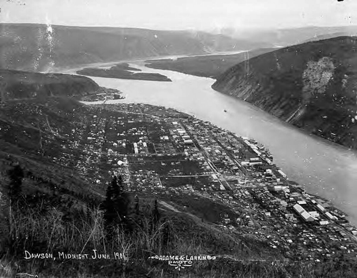
Photograph of Dawson City taken in 1901.
In the following years, using photo-topographic survey methods, Chief Inspector of Surveys Willian Frederick King surveyed 5,000 square miles along the Alaska-B.C. boundary under orders from the Canadian Border Commission.
Despite this work, the 1896 discovery of gold in the Yukon led to a stampede in the Klondike region between 1897 and 1899, which eventually led to the establishment of Dawson City in 1896 and, subsequently, the Yukon Territory in 1898.
Dawson, incidentally, was given its name by Ogilvie, who was in charge of its layout in 1897 – the name being chosen to honor George Mercer Dawson, a Canadian geologist and surveyor. All along the border, wherever a trace of gold or silver could be found, disputes over claims and land rights began to crop up more and more.
However, it all came to a head over the contested Alaskan Panhandle region.
Canada wanted a direct route from the Klondike gold fields to the Pacific fjords, whereas the U.S. wanted to maintain control of the intervening territory.
A joint commission attempted to resolve the dispute in 1898-99 but failed. The problem was then referred to an international tribunal in 1903, whose members included three American politicians, Elihu Root, Henry Cabot Lodge, and George Turner; two Canadians, Sir Allen Bristol Aylesworth and Sir Louis-Amable Jetté; and Lord Alverstone, Lord Chief Justice of England.
The Canadian and American representatives favored their respective governments' territorial claims. Based on the 1825 Treaty of Saint Petersburg, it was clear that the border should lie 56 kilometers (35 miles) east of the ocean coast, but it was not clear how the ocean coast should be defined.
The Americans argued that the coast should be defined as the point where the mainland touches Pacific water, whereas the Canadians argued that the coast was at the western boundary of the channel islands. To the Canadians' chagrin, Alverstone supported the American claim. Furious with what they saw as a betrayal by their colonial government, the Canadian representatives refused to sign the final decision. However, this act of protest did not prevent the decision from taking effect since the question had been put to binding arbitration.
Though Canada lost the Alaska boundary dispute, the event marked a significant moment in which the country began to distinguish its political interests from those of both Britain and the United States.
After gold was discovered in the Klondike region, the area saw a large influx of prospectors entering the area in search of gold. Due to the stampede, the western portion of Canada's "North-West Territories" was split from the rest of the territory in 1898 to form the Yukon Territory.
Although the gold rush ended, mining developments continued to take place in the territory during the early 20th century.
After the gold rush, the population of the territory declined precipitously, reaching a low of 4,157 in 1921, which remained fairly steady until the 1940s. This was despite the development of other mining areas, including silver in Conrad and especially near Mayo, gold in the Kluane Lake area, and copper near Whitehorse.
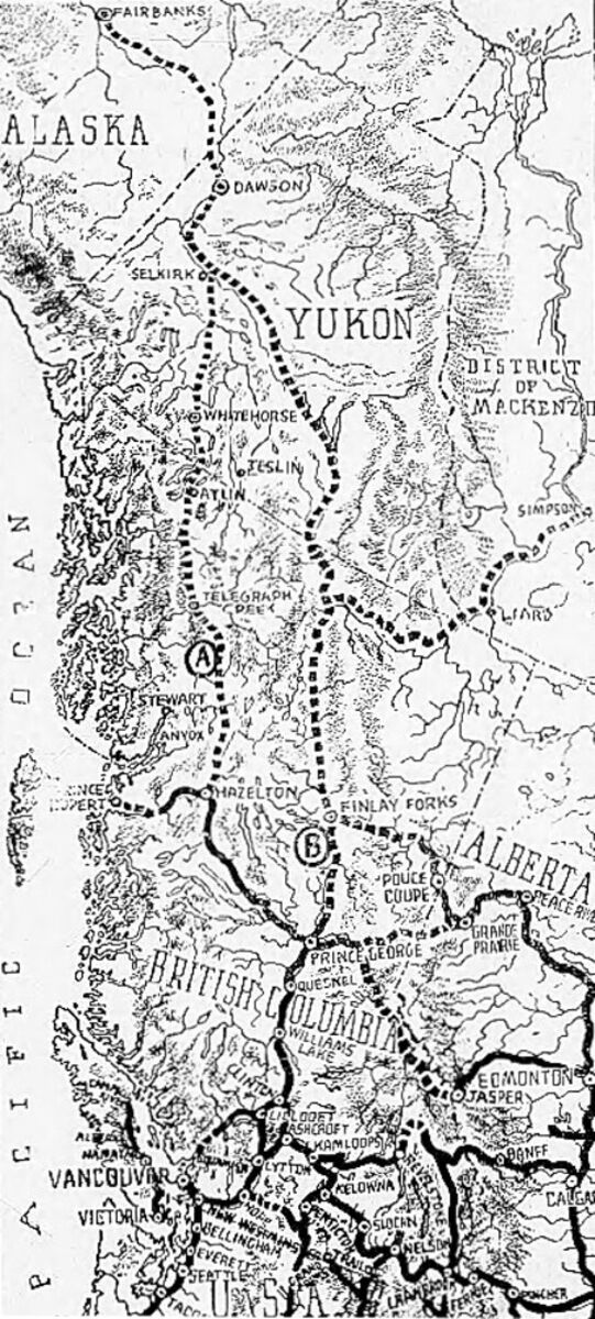
Early proposals for a highway to Alaska from Prince George, BC.
Despite this decline in population, perhaps the next most significant event since Yukon's inception would again have to do with Alaska – the construction of the Alaska Highway during World War II.
In order to better facilitate the transportation of supplies to Alaska to support its defense, construction began on March 9, 1942, after hundreds of pieces of construction equipment were moved on priority trains by the Northern Alberta Railways to the northeastern part of British Columbia near Mile 0 of the Alaska Highway at Dawson Creek, B.C.
Alaska Highway construction was a truly cooperative effort between the U.S. Army Corps of Engineers, Army engineering units, the Public Roads Administration, and contractors.
Construction accelerated through the spring as the winter weather faded away and crews were able to work from both the northern and southern ends – work that was spurred on by reports of a Japanese invasion of Kiska and Attu islands along Alaska's Aleutian Chain.
During construction, the road was nicknamed the "oil can highway" by the work crews due to the large number of discarded oil cans and fuel drums that marked the road's progress.
On September 24, 1942, crews from both directions met at Mile 588, at what became named Contact Creek, at the British Columbia-Yukon border. The entire route was completed on October 28, 1942, with the northern linkup at Mile 1202, Beaver Creek, and the highway was dedicated on November 20, 1942, at Soldier's Summit.
Built in less than nine months, the road cost around $135 million as an emergency war measure.
The original agreement between Canada and the U.S. regarding construction of the highway stipulated that its Canadian portion be turned over to Canada six months after the end of the war. This occurred on April 1, 1946, when the U.S. Army transferred control of the road through Yukon and British Columbia to the Canadian Army, Northwest Highway System.
While the Alaskan section was completely paved during the 1960s, the lower 50 miles of the Canadian portion were paved in 1959 but the remainder was largely gravel. Although the entire route is now completely paved (mostly with bituminous surface treatment), as late as the mid-1980s, the highway still included sections of winding dusty roads sandwiched between high-quality reconstructed paved segments.
The Alaska Highway was built for military purposes, and its route was not ideal for postwar use (its winding and difficult path was intended to safeguard against potential Japanese fighter pilots). Rerouting in Canada has shortened the highway by about 35 miles (56 km) since 1947, mostly by eliminating winding sections and sometimes bypassing residential areas.
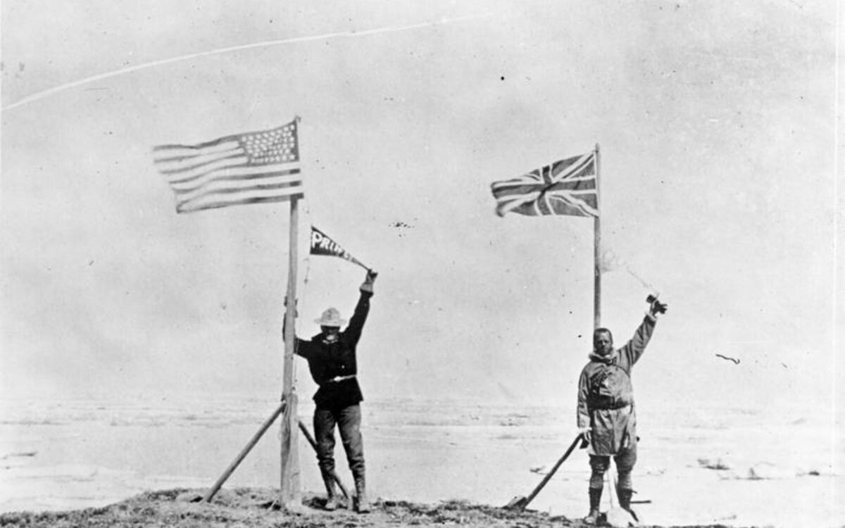
American and Canadian team leaders celebrate the end of the survey at the Arctic Ocean in 1912.
Up until 2009, rerouting continued to streamline and improve the winding road originally built as a military transport. However, today, the majority of its costs and maintenance are fronted by Yukon Territory.
With recent developments between Alaska's government and the Government of Yukon, an agreement was signed to see responsibilities for upkeep and the potential for a corridor to be expanded from Alaska through Yukon, connecting these marooned regions to the greater network of infrastructure and grids built in the south.
Whether these come to fruition or not, from the rocky start that began with the formation of its own sovereign region to an understanding after being cut off from the world after the COVID-19 pandemic, Yukon and Alaska are forging partnerships to realize a brighter future for their vast untapped Arctic regions and the hardy people that now call it home.


Reader Comments(0)